
This Monday I attended my very first Maptime Miami Meetup where Matthew Toro talked about a potentially great addition to Miami’s OSM… buildings! What makes a map detailed and fancy looking? I think it’s buildings. And landuse. And POIs. Oh well, I could continue adding items to this list for days without even starting to talk about it, really. But in any case, buildings are without a doubt the very foundation of what we can call a detailed map. Sadly, Miami’s OSM is not what we can call nice and detailed in its current state. It instantly becomes clear when you look at the map that it needs some improvement. But you know what? That’s the fun part of collaborative mapping. It’s really up to us how we build a useful map database and how detailed we want it to be. It’s us, regular people who add restaurants, bike lanes, shops and many other things we care about. Long story short, the Meetup was about importing a publicly available building dataset and making it an integral part of OpenStreetMap. I’ve decided to participate in the process, and I planned to help out with some basic stuff, throwing some ideas, maybe writing some code. You know, nothing fancy. At least that’s what I imagined. But as things rarely turn out the way we want them, now I’m the tech lead on this. Big words, I know, but they’re not mine.
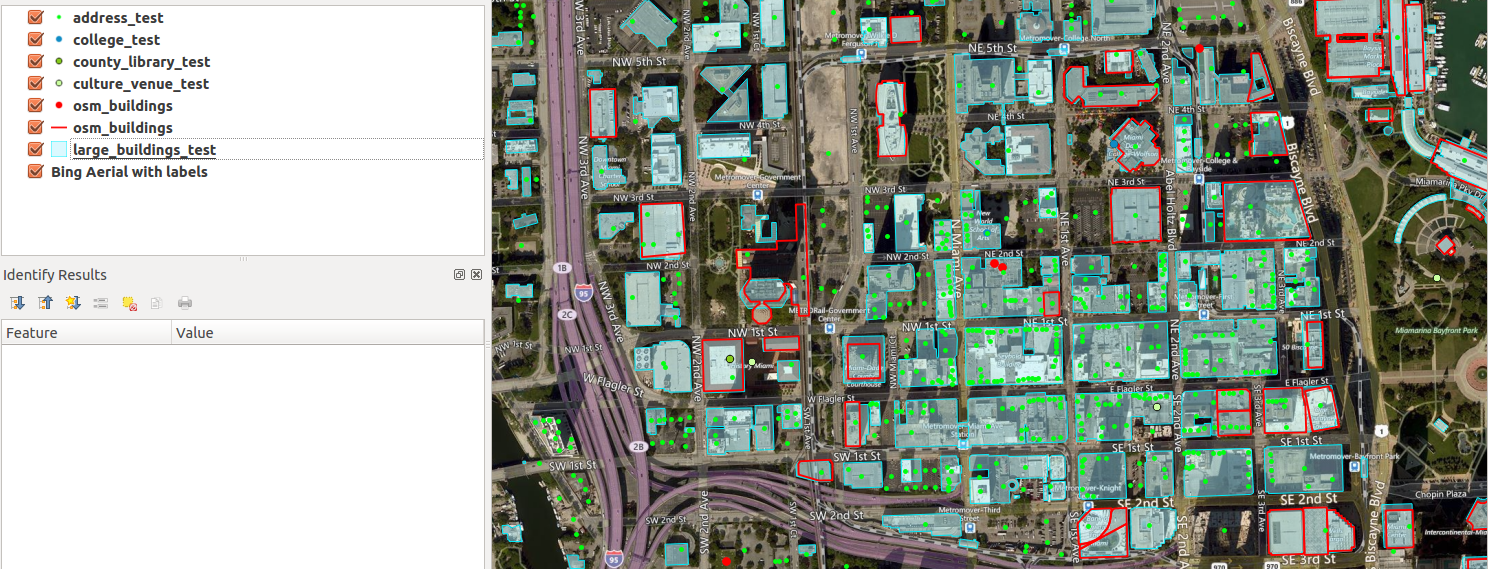
Red outline: current OSM buildings. Cyan spots: buildings to be imported. Now, that’s a lot of new buildings to add!
Anyway, the project is still in the planning phase but I’m starting to get a clear picture of all the tools and processing steps we’re going to need. Bottom line is, we are going to import almost 100,000 buildings from the county (a.k.a. Large Building Footprints) with additional information, such as addresses. Not bad, eh?
Check out our Wiki page and the soon to be populated GitHub repository. If you feel like helping out now is the time to speak up and join. There’ll be plenty of things to do for everybody. If you can help out with codes, that’s great! If you’re new to mapping but want to check how a collaborative project goes, that’s awesome! If you’re good at project management and want to oversee the progress, we need you! If you have experience with GIS but want to learn about something different, now’s your turn! If you just like looking at maps, come look at our maps! The important thing is to have fun… And here, you can have fun.
Buckle up, we’re definitely doing this! But we’re going to need you in the line, too! More info to come.

