The global State of the Map 2019 conference this year will again feature a full day of academic talks. On behalf of the Scientific Committee, I am delighted to invite you to submit your abstract.
We are looking for scientifically rigorous contributions between 500 and 800 words. Please consult the Call for Academic Abstracts for full details. Submission deadline is May 10. Questions should be sent to academic-sotm [at] openstreetmap [dot] org.
State of the Map 2019 Where: Heidelberg, Germany When: September 21-23, 2019
Scientific Committee:
Dr. Marco Minghini – EC Joint Research Centre, Ispra, Italy Dr. A. Yair Grinberger – Heidelberg University, Germany Dr. Peter Mooney – Maynooth University, Ireland Dr. Levente Juhász – Florida International University, USA Dr. Godwin Yeboah – University of Warwick, UK
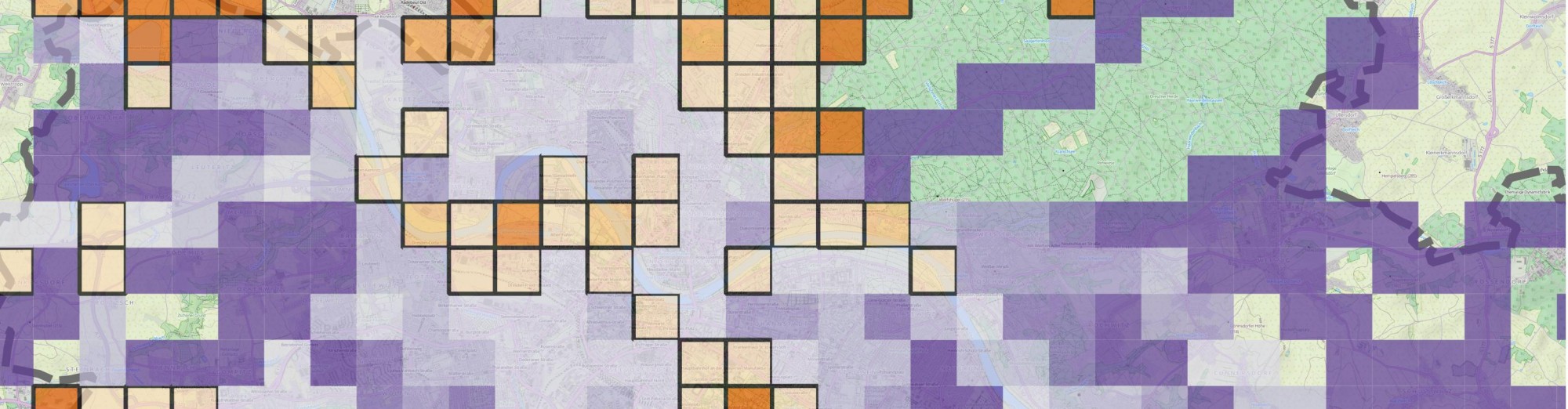
Oops, I forgot to share my “new” videos I made this June. Better later then never, I guess. Anyways, it’s part of my research that aims to understand how regular people on the Internet use different mapping platforms. Well, not just mapping platforms but basically any platforms that you can think of including Instagram, Foursquare, Twitter, Facebook an many more. We know that many of you use multiple services during your daily routines. Previous research focused on each of these data sources separately so we have a lot of knowledge on them (not playing the Big Brother here, I’m talking about an aggregated level). However, we do not yet know how the same individual uses these services simultaneously. Do activity spaces overlap? Is there a single main service or do people use different services with the same intensity? Does the introduction of a new service affect previous usage patterns? Can the user base from a platform drained by another? How do these processes work in time and space? Well, and I have many more questions. Probably way more questions than I can realistically answer, especially when don’t just talk about simple social media photos but really high quality mapping activities (as in editing OpenStreetMap and taking Mapillary street level photos specifically for mapping).
Nevertheless, I started working on this kind of research and made some early visualizations. Below are two videos showing how OpenStreetMap users pull images from Mapillary and edit the map based on other people’s contributions. How crazy is that? You grab one source of user generated content to improve another? Who would have thought about that 5 years ago?
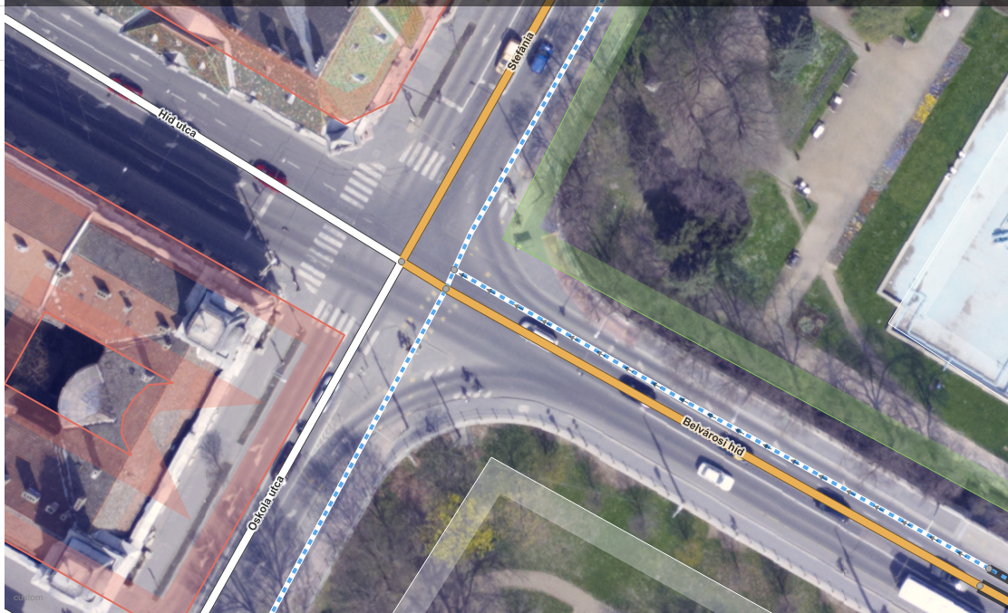
The first map shows to what extent an OSM mapper loaded Mapillary photos to his editor (cyan rectangles) and showcases (with labels) whenever an editing activity based on those photos could have been identified. It means that people really check photos over an extensive area just to see if they can find some new details to add to the map. I think it’s impressive.
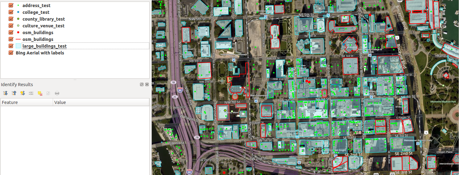
This Monday I attended my very first Maptime Miami Meetup where Matthew Toro talked about a potentially great addition to Miami’s OSM… buildings! What makes a map detailed and fancy looking? I think it’s buildings. And landuse. And POIs. Oh well, I could continue adding items to this list for days without even starting to talk about it, really. But in any case, buildings are without a doubt the very foundation of what we can call a detailed map. Sadly, Miami’s OSM is not what we can call nice and detailed in its current state. It instantly becomes clear when you look at the map that it needs some improvement. But you know what? That’s the fun part of collaborative mapping. It’s really up to us how we build a useful map database and how detailed we want it to be. It’s us, regular people who add restaurants, bike lanes, shops and many other things we care about. Long story short, the Meetup was about importing a publicly available building dataset and making it an integral part of OpenStreetMap. I’ve decided to participate in the process, and I planned to help out with some basic stuff, throwing some ideas, maybe writing some code. You know, nothing fancy. At least that’s what I imagined. But as things rarely turn out the way we want them, now I’m the tech lead on this. Big words, I know, but they’re not mine.
Red outline: current OSM buildings. Cyan spots: buildings to be imported. Now, that’s a lot of new buildings to add!
A year ago, high quality aerial imagery with a 10cm ground resolution was made available to the OSM community in Szeged, Hungary. It’s a very good example of not just sitting on the data but trying to make use of it. In theory, OpenStreetMap community can absolutely benefit from having a data source like this as there are way more details to be derived from such high resolution imagery. Also, the positional accuracy of the orthophoto is worth mentioning. You know, this is the kind of aerial photograph that you can make measurements on, like if it was a true map. It’s important because you can skip playing with different offsets and dragging your base map around to make it appear in its “true” position before you can actually start mapping. So, truth’s been told. It’s cool, but what the heck is with it?
Well, It’s been a year or so. I can talk about the benefits for days but it doesn’t really matter if no one is acting accordingly, right? There are things that “should” work in theory but when it comes to online communities… well, that’ a whole different story. Anyway, let’s lurk around and see what awesome mappers of OSM think about all this (oh, did I just say awesome people of OSM? Is it a spoiler? Oh well, I guess you have to click on the link below and read more to figure it out.)
In my spare time, I teamed up with my old colleagues, the lovely faculty members at the University of Szeged, Department of Physical Geography and Geoinformatics to ask them for data donation. I couldn’t be happier to announce that after months of procrastination, some other delays and some more months of procrastination on my side, finally I am able to release a high resolution aerial imagery to the OpenStreetMap community for the solely purpose of mapping.
Végre sikerült összehozni egy régi tervemet. Nagy örömömre szolgál bejelenteni, hogy a Szegedi Tudományegyetem Természeti Földrajzi és Geoinformatikai Tanszéke jóvoltából az OpenStreetMap közösség szabadon felhasználhatja a Szeged körtöltésen belüli részéről 2011-ben készült, nagy felbontású ortofotó állományt térképszerkesztés céljából.
Today, a new project appeared on Kickstarter from the founder of OpenStreetMap, Steve Coast. I highly encourage everyone (in case you can) to stand for it so we can enjoy some insights about OSM. It’s pretty interesting how more than 1/5 of the goal have been pledged in less then 1 day.
In addition, enjoy a recent talk about the project.